Home
Project Information and FAQs
Project Information and Frequently Asked Questions
Project information posters
Background
Our aim is to transform the A432 and A4174 Avon Ring Road route between Yate and the Coldharbour Lane junction on the A4174 to give residents and visitors improved options for using buses, walking, cycling and those who require the use of a wheelchair or pushchair. This includes Station Road in Yate and Badminton Road from Yate, through Coalpit Heath to the Wick Wick roundabout onto the A4174 Avon Ring Road.
Proposals include improvements to bus stops, new and improved pedestrian crossings, segregated cycle paths, junction improvements and high-quality walking and wheeling (use of a wheelchair, scooter, or pushchair) facilities.
The scheme is being developed and will be delivered by South Gloucestershire Council as part of a wider programme of works aimed at improving public transport and active travel throughout the region, linking with other existing and proposed routes to create an integrated network, opening up more places to sustainable travel. It is funded by the Department for Transport (DfT) through the City Region Sustainable Transport Settlements (CRSTS) Fund, administered by the West of England Combined Authority (CA).
The delivery of this project is consistent with the principles set out in the Yate Masterplan. This is the first phase of the delivery of the masterplan and future phases will build on this delivering the wider aims.
For further information on the CRSTS project, please visit the West of England Combined Authority's webpage here.
The A432 and the A4174 Avon Ring Road are important local roads, seeing thousands of trips every day, as people travel between communities, access amenities or travel to work, school, or college.
Along the ring road there are several major employers such as the Ministry of Defence (MoD), the Bristol and Bath Science Park and University of West of England (UWE). It is also a key route into Bristol city centre, linking many towns and villages and connects to the wider motorway network.
We want to make walking, public transport and cycling not only viable, but the preferred way of getting around – especially for shorter journeys. To achieve this, we must make alternatives to the motor vehicle more reliable, safe, and convenient to users. This scheme supports sustainable transport investment along one of our busiest and most heavily congested roads.
There are currently a small number of well-used facilities for walking, wheeling, and cycling along the A432 and the A4174, with large gaps along the route where there are no dedicated cycle lanes. You have told us that more improvements are needed to make walking, wheeling, and cycling feel safer and to make it a more pleasant experience.
We recognise that some people will still need to use a car for some of their journeys and as more people make the switch to sustainable travel, the number of vehicles on the road will reduce. Less traffic will mean less congestion for those who still need to travel by car.
We need to do both.
The money allocated to this scheme has come from central government specifically to improve active and sustainable travel. We are limited in its use and are not allowed to use it for other schemes, i.e. road repairs. Either we use it for active and sustainable travel at the identified location or we have to return unused funds to the government.
Presently, travelling by motor vehicle is a convenient way of getting around for many journeys. But this reliance has some significant down-sides:
- Environmental damage due to carbon dioxide emissions,
- Health impacts due to:
- increased pollutants in the air that we breathe,
- noise from traffic
- road traffic collisions
- Congestion and delays because cars take up more space on the road than alternative options like public transport or cycling,
- Less money to spend on more positive initiatives due to increasing spend on fixing roads damaged by vehicles,
- Less resilience and options when things change, such as unexpected/unplanned road closures, flooding or other extreme weather events or public health emergencies such as the pandemic. More choice equals greater resilience.
- Car dependency also exacerbates social inequality, with the lowest income households having higher levels of non-car ownership. To promote a more socially inclusive transport mix, improvements must be made where we efficiently use the space available to improve transport options for all.
Our growing population will also add to these issues.
The population of the region is expected to rise from 1.1 million people in 2016 to 1.3 million in 2036. Without this positive and targeted action, modelling indicates this will lead to a 26% increase in trips on the road network by 2036, increasing average delays per vehicle by almost 40%. This will be worse along busy routes like the A432 and the A4174 Avon Ring Road.
Currently in the West of England:
- Two in three commutes to work are by car, primarily because people have limited alternative options,
- Two in five commutes are less than 2km, a distance which almost all of us could walk, wheel, or cycle.
Transport represents the largest source of emissions locally (32% of CO2 is generated by transport in the West of England compared to 26% nationally).
These proposals are part of a wider programme through which we are seeking to deliver a step-change in making walking, cycling and public transport not only viable, but the preferred way of getting around, especially for shorter journeys.
The West of England Combined Authority has been given money by central government to implement schemes which have the greatest potential to make the biggest difference. Local councils in the region are working together on local projects, with the aim to join up, creating an integrated active travel network, increasing the range of transport options for residents, businesses, and visitors.
This project will not impact on funds available in South Gloucestershire for other council services.
This money has come from government specifically to improve active and sustainable travel.
Investment in active travel provides a number of benefits that support the government’s wider strategic priorities to improve air quality, increase physical activity and achieve net zero emissions by 2050, amongst others.
This is part of the government’s long-term vision to make England a walking and cycling nation. The plan, called Gear Change, includes the ambitious goal that half of all journeys in towns and cities will be walked and cycled by 2030.
Active Travel England (ATE) was set up specifically to lead on achieving this objective. It is a condition of the funding that ATE review and approve the scheme.
This scheme is part of a wider transport package of improvements set out in the Joint Local Transport Plan 4 (2020-2036) for the West of England which, after consultation in 2019, was adopted as policy by the West of England local authorities, including South Gloucestershire Council. This document sets out the priorities for investment in the area including the A432 and A4174 corridor improvements for walking, cycling, wheeling and enhanced bus services between Yate and Bristol.
The South Gloucestershire Cycling Strategy 2016 identifies the A432 connection between Chipping Sodbury and the north fringe of Bristol as a Strategic Cycle Route with segregated cycle lanes where possible.
The West of England City Region Sustainable Transport Settlement commits to investment for the A432.
The Combined Authority’s Bus Service Improvement plan (link here) also identifies the A432 and the A4174 as a “High Priority Investment corridor” with the commitment to work with bus operators through a partnership agreement to deliver a higher frequency of services.
Benefits to you
This scheme will bring many practical, health and environmental benefits to local residents now and into the future.
New high-quality walking and cycling tracks will make it safer and more attractive to walk, wheel or cycle along the A432. Along Station Road in Yate this will be supported by a new 20mph speed limit. The National Travel Attitudes Survey (NTAS) found that 66% of adults over the age of 18 agreed that "it is too dangerous for me to cycle on the roads". The figure was even higher for women, at 71%.
The proposed improvements will address safety concerns and will be designed to be suitable for use by people of all abilities. It is not acceptable that people with disabilities and people pushing buggies cannot get to their destinations safely, because there are not enough safe crossing points for them to use.
Additionally, upgrading local bus stops will make them more attractive to use.
We want to support active and healthy lifestyles. Walking and cycling have proven health benefits and are known to prevent long-term health conditions. Healthier lifestyles also save the NHS millions of pounds every year and reduces demand on our health services.
Reducing the number of cars on the road will also improve local air quality making a more pleasant environment for those people who live close to or travel along the route.
The proposals include changes to several bus stops along the route including new bus shelters where feasible and removing laybys at some bus stops to reduce bus journey times.
We continue to work with bus operators and the West of England Combined Authority, (who are ultimately responsible for bus services), to deliver a service which gets people to the places they need to go, at the times they need to travel. As part of the Bus Service Improvement Plan, we aim to provide the infrastructure to allow for operators to deliver the services required.
By investing in infrastructure, such as improved bus stop facilities like shelters and raised kerbs, more people will choose to catch a bus. With more passengers, the financial model works, and bus operators will introduce services to more places and increased frequent services on existing routes. This in turn, will attract more people to switch, which makes more services financially viable, which means more services can be offered.
Please take a look at the maps provided for details of proposals.
The proposals include a number of measures which will improve facilities for walking, wheeling, and cycling. These measures will make travel safer and a more enjoyable experience for those choosing to walk or cycle and those people who use a wheelchair, buggies, or mobility scooter.
Separating cyclists from traffic, and cyclists from pedestrians and wheelchair users will reduce conflict and improve safety for all road users.
The new walking and cycling facilities will be designed in accordance with the Department for Transport’s Cycle Infrastructure Design guidance (Local Transport Note 1/20) with the aim of ensuring safety for cyclists and pedestrians.
Please take a look at the maps provided for details of proposals.
Separating cyclists from motor vehicles, and cyclists from pedestrians and wheelchair users will reduce conflict and improve safety and accessibility for all road users.
We are proposing to use dropped kerbs and tactile paving with clear road markings and signage at crossings to improve accessibility for wheelchair users, deaf and blind people.
Priority at side road junctions will also be given to people who are walking, cycling, or wheeling across side roads, supporting the latest changes to the Highway Code and priority hierarchy at side roads.
It is not acceptable that people with disabilities and people pushing buggies cannot get to their destinations safely, as there are not enough safe crossing points for them to use.
Bus stops will be designed in a manner that is inclusive for all, providing suitable shelter (where applicable) and space to wait, whilst improving access for all bus users. There will be instances where cycle lanes will be guided behind bus stops, via a bus bypass. These will be designed to reduce bicycle speed, whilst providing priority crossings for pedestrians.
The impact of motor vehicles and their contribution to increased levels of Nitrogen Oxides (NOx) and particulate matter (PM10/2.5) in the atmosphere, damaging the environment and our health, is well documented. See this link improving_air_quality_walking_cyling.pdf (sustrans.org.uk)).
Improving journeys for more people to walk, cycle or catch a bus – especially short trips – will help reduce the use of motor vehicles on our roads, and will improve air quality along the Badminton Road.
Listening to you
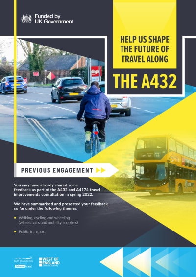
In early 2022, we sought your views on proposals along the A432 and A4174 route. We analysed the responses and used them to inform the detailed design work.
In early 2023, we held a community drop in for local people to tell us about travel along Station Road in Yate.
Topics raised included:
- Public transport
- Parking
- Public areas
- Junction improvements
- Walking, cycling and wheeling access.
We have also held focus group sessions with local residents where we have further discussed issues around travelling along Station Road. We have also used these sessions to develop proposals.
Further information on how we have responded to your views and previous engagement can be found on our project information posters at the top of this page.
A summary of the feedback we have received during the Station Road engagement can be found on our Station Road webpage.
The proposals
There are currently very few signal-controlled pedestrian crossings along the A432, especially in the village of Coalpit Heath, particularly near local amenities and bus stops. Those walking or using a wheelchair currently have to travel unreasonable distances to use a signal-controlled crossing.
Our proposals include installing new signal-controlled crossings along Badminton Road near to:
- Ruffet Road
- Down Road
- Park Lane / Station Road
- Southview Crescent
- Woodside Road
- Church Road
- Heathcote Drive
- Nibley Lane
- Westleigh Close
We are also proposing installing new and additional signal-controlled pedestrian crossings at the Beesmoor Road, Church Road, Longs Drive and Cranleigh Court Road junctions.
On Station Road, the siting of a new crossing to support access to Yate Station and the surrounding network is proposed between Westleigh Close and Sunnyside Lane that considers the proximity to existing junctions and access to private residences. This strikes a balance by centrally locating a pedestrian crossing, whilst considering the need for those using the bus stops at this site.
The Yate Masterplan includes a vision for enhancing Yate station and the provision of public realm improvements to support the station. As this element is progressed further opportunities to enhance accessibility to the station that cannot currently be achieved within the highway boundary.
When considering the type of crossing, their frequency, and their location, a number of factors are taken into consideration to determine what type of crossing is appropriate. This includes the needs of all road users, with safety being the most important design consideration throughout.
Active Travel England (ATE), the organisation which will be required to authorise the final scheme design, has minimum requirements for crossings. They stipulate formal crossings points be provided at regular intervals along busier routes, like the A432 Badminton Road.
Most importantly, additional signal-controlled crossings will make it safer for all pedestrians, especially vulnerable road users. It is not acceptable that people with disabilities and people pushing buggies cannot get to their destinations safely, as there are not enough safe crossing points for them to use.
There may be some impact on traffic flow but the wider benefits, especially to vulnerable road users, outweigh this.
A continuous cycle route through Coalpit Heath is critical to the overall success of the wider strategic improvements. With current infrastructure provision, connectivity through Coalpit Heath by walking, wheeling, and cycling is limited, and is presently often an unattractive user experience.
The needs of pedestrians and cyclists must be addressed to ensure that cycling and walking becomes an attractive option for those travelling around and through Coalpit Heath.
Though some cycling provision exists along the A432 through Coalpit Heath, it does not currently meet the required national design standards. The experience for walking, cycling and wheeling journeys is mixed, as well as the road safety for all users. Delivery of high-quality cycling infrastructure suitable for ages 8-80 is necessary (but is not without its challenges).
To reflect the ‘High Street’ nature of Station Road, we plan to implement a 20mph speed limit. This speed limit change will encourage more residents and visitors to walk and cycle, which can lead to a reduction in congestion, air pollution and associated car use. It will also make wheeling a safer and more pleasant experience.
A 20mph speed limit will improve safety for all road users, as this significantly reduces the likelihood of casualties, if an incident were to take place, with evidence noting that where higher speeds exist, more collisions are likely.
Additionally, through speed reduction measures and associated changes to the layout of Station Road, we hope to reinforce the existing weight restrictions on Station Road, discouraging the throughput of Heavy Goods Vehicles (HGVs) on this road.
An additional 10 car parking spaces have been designed on Station Road, outside the Whirlpool site, to support people accessing local businesses. This will include a number of disabled parking bays. We intend for these bays to be short-term, and these will be consulted on separately via a Traffic Regulation Order (TRO).
The scope of the project limits the opportunities for expanding off-street parking provision in proximity to Station Road but this remains an area of interest that will continue to be explored outside of this project. Increased wayfinding to the current off-street parking, accessed via Longs Drive, will be included.
The 2022 consultation highlighted that the majority of participants were supportive of a continuous, segregated cycle route along (with bus stop improvements) on the main A432 through Coalpit Heath (on-line route).
Two potential options were presented during the consultation, an on-line and an off-line route. A number of concerns were raised about both the on-line and off-line cycle routes. - We believe our proposals address these concerns.
As part of the funding requirements, the scheme must meet the minimum standards of cycling provision, as set out in DfT guidance LTN 1/20. This notes that, to make routes accessible for all, they must be:
• Coherent
• Direct
• Safe
• Comfortable
• Attractive
The proposed on-line route, along Badminton Road, would directly connect with routes north and south of Coalpit Heath, linking with existing (well used) segregated cycle lanes between the village and Yate and would provide a route as direct as motor vehicles.
To meet the funding requirements, the route must be as direct, if not more direct than the route taken by motor vehicles. There is an existing network of quieter routes, linking Coalpit Heath with Ruffet Road and the surrounding area, which, as noted during the 2022 consultation, was seen as more of a ‘leisure’ route. These quieter routes will benefit from improved signposting as part of this project.
We have received positive feedback for the existing cycle track between Coalpit Heath and Nibley, however, there have been some requests for improvements to the route from residents and visitors that will enhance the existing provision.
The extent of these improvements is currently being determined, and subject to approval, they will be implemented as part of this scheme.
The council has carried out annual surveys along the current Badminton Road cycle lanes between Coalpit Heath and Nibley Lane since they were installed in spring 2022. Our data shows that there has been an increase in the number cyclists and pedestrians using these improved facilities.
During October 2023 there were 6,400 cycle journeys along the new cycle lanes. This represents a 36% increase since October 2022.
Through the proposals put forward as part of this project, we will be providing links to a variety of destinations, opening routes which are currently only on-road without any segregation, such as Coalpit Heath and Station Road. When these changes have been made, we anticipate that these figures will have even more of a significant uplift.
The bus laybys at the following locations will be removed to help reduce delays to bus journey times:
- St Saviour’s Church (southwest bound)
- Cuckoo Lane (northbound)
- Park Lane (southbound)
- Nibley Lane (northbound and southbound stops)
- Longs Drive
When a bus has to manoeuvre in and out of traffic to use the bus laybys, this has an impact on bus journey times, compromising bus priority and can make bus travel less reliable and appealing.
This change reflects the government's latest available guidance on bus infrastructure, as referenced in Local Transport Note 1/24 Bus User Priority[1]
A consequence of the proposed changes will be that vehicles exiting or accessing private driveways or businesses will need to cross the new cycle tracks in addition to the existing footway, where applicable.
Drivers would need to check for passing cyclists in the same way they currently do for pedestrians using the footpath and vehicles on the road. The designs ensure maximum visibility for cyclists and drivers.
Examples of other, similar schemes that have been built are also provided here so that you can understand how the scheme will affect entry and exit into your property.
Dutch kerbs allow for safe vehicular crossing over footways and cycle lanes. Drivers will need to consider pedestrians and cyclists using the footways/cycle lanes and to exercise caution and be aware.
An example of a Dutch kerb is shown as a scheme image here. The images provided are not the final design. The scheme may look different when implemented.
We had previously shared with the Coalpit Heath community two options for the Church Road junction.
The first option was an amendment to the existing T-Junction, providing additional formalised crossing points for pedestrians and cyclists, whilst retaining the right turn lane.
The second option was a mini roundabout, removing the right turn lane, whilst introducing formalised crossing points for pedestrians and cyclists.
Following feedback we received at the community drop-in earlier in the year, the majority were in favour of the T junction design to maintain the flow on the A432, therefore we are progressing this option.
At the Beesmoor Road junction we are proposing separate crossings for cyclists and pedestrians, as well as installing additional signal-controlled crossings on the Beesmoor Road and Henfield Road arms of the junction, with the right-turn lanes on Badminton Road retained.
This type of junction is known as a Cyclops Junction, where cyclists are separated from motor vehicles and pedestrians, making the junction safer for all road users.
The current crossings operate on an ‘all red’ phase, where all arms of the junction are turned red for motor vehicles, allowing pedestrians to cross. The proposed Cyclops Junction will operate in a similar manner, reducing the impact of vehicle delays.
At the Ruffet Road/ Down Road junction, we are proposing new signalised crossings across Badminton Road and Down Road for pedestrians, cyclists, and equestrians. We are also proposing to remodel the Ruffet Road junction to a single entry/exit, and install a Parallel Crossing, which separates pedestrians and cyclists, allowing them to both cross safely, subject to successful land negotiations.
At the Park Lane junction we are proposing to introduce a new signalised crossing for pedestrians, along with bus stop improvements. The cycle path through this section will be shared use, due to the limited available space.
There will be some changes made to the layby to improve access for vulnerable road users, however it will be retained for usage as part of these proposals.
At the Nibley Lane junction we are proposing to introduce a new signalised crossing for pedestrians and cyclists across Badminton Road, along with a priority crossing for pedestrians and cyclists across Nibley Lane to improve safety.
At the Stover Road junction we are proposing a new parallel crossing for pedestrians and cyclists, as well as changes to the kerb and stop line alignments to improve capacity at this busy junction.
At the Culvert Avenue roundabout, we are proposing a new signalised crossing for pedestrians across Badminton Road on the eastern arm, utilising the existing roundabout as currently designed.
There are existing facilities for those walking and cycling to cross the northern and western arms of the roundabout which will also be retained, linking the proposed segregated cycle paths east and west of this roundabout.
At the North Road junction, we are proposing a new parallel crossing for pedestrians and cyclists. To facilitate wider improvements, and to ensure the junction functions optimally, the right turn from Station Road to North Road has been removed.
At the Longs Drive junction, we are proposing a new parallel crossing for pedestrians and cyclists. This includes the removal of the existing bus layby, north of Longs Drive, to facilitate this change.
At the Cranleigh Court Road junction, we are proposing a new parallel crossing for pedestrians and cyclists. This will involve re-locating the existing memorial to the opposite side of the junction. What is happening to the Newman’s memorial?
Station Road has limited space available for making changes. To successfully install a footpath and separate cycle lane of sufficient width, we will need to move some existing street furniture, including the Newman’s memorial. We plan to relocate the memorial to the opposite side of the Cranleigh Court Road junction, where there is more space for those wishing to pay their respects at this site.
Our proposals will make it safer and easier for people to swap car journeys for walking, cycling, or use public transport. As more people make this switch to sustainable travel the number of vehicles on the road will reduce. Less traffic will mean less congestion for those who still need to travel by car.
Construction
Cost estimates are being developed as part of the design process and the current allocated budget is £34.7 million. However, this is for the entire scheme and for improvements along the whole of the A432, including Station Road and Badminton Road, and the A4174 Avon Ring Road.
Funding for the improvements will be provided by the West of England Combined Authority’s funding from Central Government and will not impact on funds available in South Gloucestershire for other council services.
A Full Business Case, along with a funding request, will be submitted to the Combined Authority once detailed design has been completed. The money available for this project can only be used for new transport infrastructure. The financial restrictions on public spending mean that capital funding from Government (this funding opportunity) must be spent on improving highway assets and cannot be used for funding bus services, filling potholes or other day to day funding such as social services, education, or libraries.
As part of the detailed design work, we will look to understand what the future maintenance requirements and cost implications will be.
Should this scheme be progressed, construction is planned to commence in early 2025. It is possible that some elements could be undertaken earlier to coincide with current closure of the M4 overbridge on the A432. We anticipate that overall, construction works may take between 18 months to two years to complete. Given the length of the route it is likely that works will be phased so only certain sections will be worked on at any one time.
South Gloucestershire Council will work with the appointed contractors to minimise disruption to traffic and maintain access to properties. However, this needs to be balanced with ensuring safety for the public and workforce around work sites.
Other
Any proposed design in proximity to the M4 overbridge has been carried out to effectively tie-in with any proposals brought forward by National Highways for the new bridge.
For more information on the M4 overbridge please look here: A432 Badminton Road M4 overbridge closure | BETA - South Gloucestershire Council (southglos.gov.uk)
No changes to bus services are currently proposed as part of the scheme. The Combined Authority is working with operators to establish an Enhanced Partnership to improve bus services across the West of England which will cover both commercially operated services and those operated with financial support from the Combined Authority. A list of supported services is provided at Appendix 2 of the West of England Bus Service Improvement Plan. Any future changes to bus services will be consulted upon separately by the relevant operators and the Combined Authority.
Since declaring a Climate Emergency in 2019, the council has taken urgent steps to minimise environmental damage and to prepare for the local impact of climate change and reducing carbon emissions. Transport is a key generator of carbon emissions and represents the largest source in district emissions.
We want to deliver a step-change in making walking, cycling and public transport not only viable, but the preferred way of getting around – especially for shorter journeys. To do this, we must make alternatives to the motor vehicle more reliable, safe, and convenient. This scheme supports that sustainable transport investment.
The project will be developed in a way that seeks to reduce any impact on the environment, where possible. We will be developing a tailored Landscape Ecological Management Plan (LEMP) to ensure we protect and enhance biodiversity and landscape during and following construction.
In addition, a carbon management process for design and construction, looking to promote carbon reduction where possible, will be developed for the scheme. The carbon performance of the scheme will also be calculated, quantifying potential road user emission savings from mode shift against the capital carbon cost from construction. This will be submitted as part of the business case for consideration by the West of England Combined Authority.
Following this consultation period, all of the feedback received will be reviewed and taken into account, while detailed designs are being worked on by consultant designers. A Full Business Case (FBC), along with a request for funding, for the scheme is due to be submitted to the West of England Combined Authority in late 2024.
We welcome all comments and feedback. Please complete the feedback survey provided on this site. You can also register for future project updates. If you have a question please email Transportservices@southglos.gov.uk
Consultation for the A4174 proposals was completed in 2023 and a Full Business Case is being submitted Summer 2024.
For further information on these proposals please visit the website here: Have Your Say Today - A4174 Avon Ring Road Improvements - Commonplace
This engagement phase has finished

...